Part 1
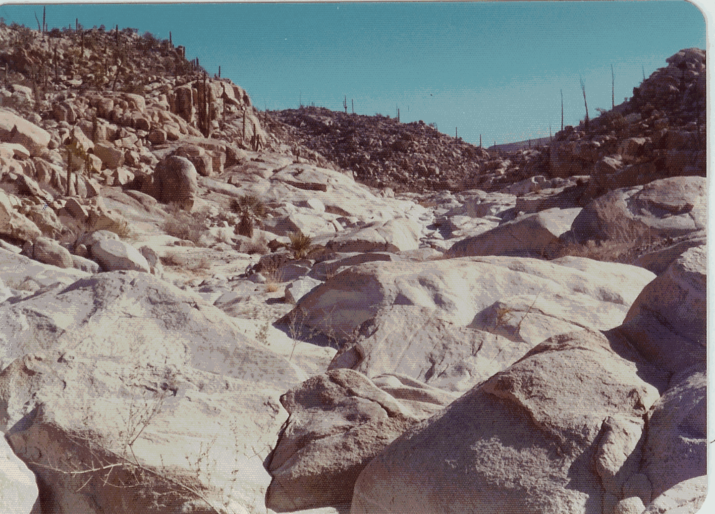
Sometime about 1973-4 Gerry, Dan and I took a camping trip to Baja. We traveled in Dan’s 4WD Travelall. (In the south it’s called a Haul Ya All!) We had planned to gather up Glenn at San Miguel, but there was some sort of crisis that he needed to handle, so he did not make the trip. We headed out east of Ensenada, toward San Felipe, on Mexico Three. My recollection is that no more than twenty or thirty miles was paved at that time. The road followed a high valley between the Sierra Juarez and the coastal range of mountains south to Valle Trinidad. There we turned east again, toward the gulf. Shortly after going through San Matias Pass, we left the main road, turning south through the desert and past a dry lake. San Matias, by the way, is the lowest pass over the peninsular divide between the California border and several hundred miles to the south. We were now skirting the eastern base of the Sierra San Pedro Martir. We found a road that brought us very near the opening of Arroyo del Diablo. There was a nice stream of water in the arroyo, and we followed it as far as we could without climbing gear. As we went up the canyon we observed that we were in a different habitat. It was the middle of winter, but there were wild flowers blooming near the stream. We found a long aluminum extension ladder at a place that was otherwise not passable. It must have been put there by some of the climbing expeditions that climbed El Picacho from the east side. We had a nice bath in the very cold water, and then went on south.
We passed through San Felipe, then Puertecitos, and arrived at Bahia San Luis Gonzaga in time to have dinner at Alfonsina’s Restaurant. The road both north and south of Puertecitos was truly about as bad as I have ever seen in Baja. We camped just south of the bay. That must have been our second night out. I don’t seem to remember the first camp.
The next day we drove on south on dirt roads, passing the site of the old Mission of Calamajue. We finally got to the main highway at El Crucero. There we turned north, taking a little detour to El Marmol. Even though I had made two driving trips to Bahia de Los Angeles, 1936 and 1953, we never seemed to have time to go to El Marmol.
El Marmol was an Onyx quarry that operated almost continuously from the very early 1900’s. It had shut down some years before our visit. In the very early days the slabs of onyx were hauled by mule drawn wagons to the Pacific at a place called Santa Catarina, not to be confused with the reservation of the same name. Later I think they had engine driven vehicles for this purpose. The slabs were loaded onto lighters to be taken to larger ships for transport to San Diego (Southwest Onyx). When we lived in San Telmo the Onyx was being hauled by truck directly to San Diego. The deeply worn road from El Marmol to Santa Catarina was still very visible in places.
We spent a long time looking at all the old equipment and buildings. The little schoolhouse, made entirely of onyx blocks, was still standing. We also spent a long time in the cemetery. Cemeteries tell a story of their own. The dates show a succession of sicknesses of one kind or another, sometimes wiping out entire families.
Our guidebook showed a road continuing eastward, so we decided to see where it went. After traveling in dry washes, on long ridges and some flat ground, we dropped into what our map showed to be Arroyo Volcan. There was a little stream of water here. We hiked upstream a mile or so, and as we went we found small pools of water with limestone deposits all around the edges, and colored algae on the bottom. They were much like the pools in Yellowstone, in miniature!
Where we made camp in this arroyo there was a very large overhanging rock. This rock was quite black from many campfires. Also on the rock were paintings that seemed to be just like all the pictures we had seen of the cave paintings in Baja. We wondered if they were real or counterfeit. Since the road we had traveled on was obviously new, and went nowhere that would attract the casual traveler, we decided that the paintings must be authentic.
The next day we drove to the end of the road, another few miles. The road followed downstream for a bit then turned south along the face of the rather steep escarpment that ends at the (Gulf) coastal plane. At the end of the road was a level pad barely wide enough to turn around on that had been created by an excavation of the cliff above it. There was no equipment of any kind, so it was obvious that the project, whatever it was, had been abandoned. From the end of the road we were looking down at the Gulf of California.
On our way north we stopped at El Rosario for gas and late breakfast or early lunch. Eraclio Espinosa and his wife, Anita, owned the service station and restaurant. They were long time friends of my folks. When I asked Eraclio about the mining operation we had seen, he went to great pains to be sure that we understood that it was not a mine, but a "prospect". This led me to believe that he was somehow involved, and that for reasons having to do with government permits and royalties he wanted to make that distinction. There are times in life that it is best to let sleeping dogs lay!
It was a great trip. We saw lots of country that we had not seen before, and left lots more to be explored another day!
Part 2
In January of 1976 Barbara and I, along with Ted and Polly Walck, drove our motorhomes on the newly completed Mexico 1 to Cabo San Lucas and back. I had asked my father to make up a list of things to see and places to park overnight. When we arrived at San Miguel, he had already started south on his own trip, but the list was waiting for me. FYI- we have always addressed our parents as Tom and Dorothy, so in this narrative Tom is my father; David is one of my sons. Tom had with him his traveling companion, Jose Cesena, David, and Dominican Father Walsh. I think their primary objective was to put up some signs at San Borja.
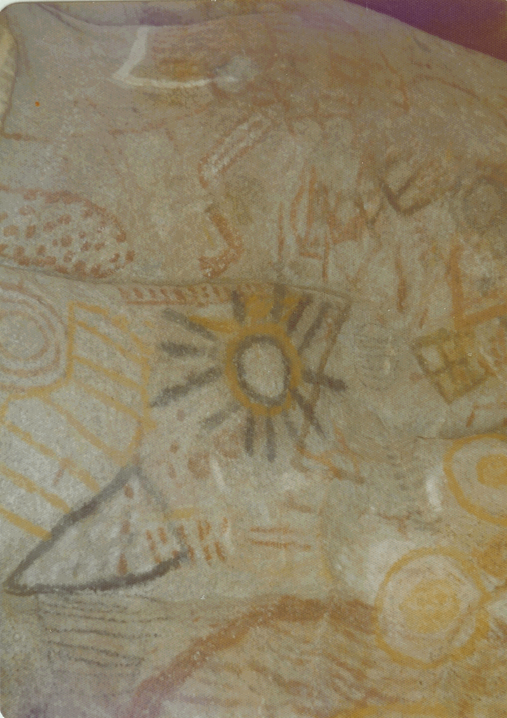
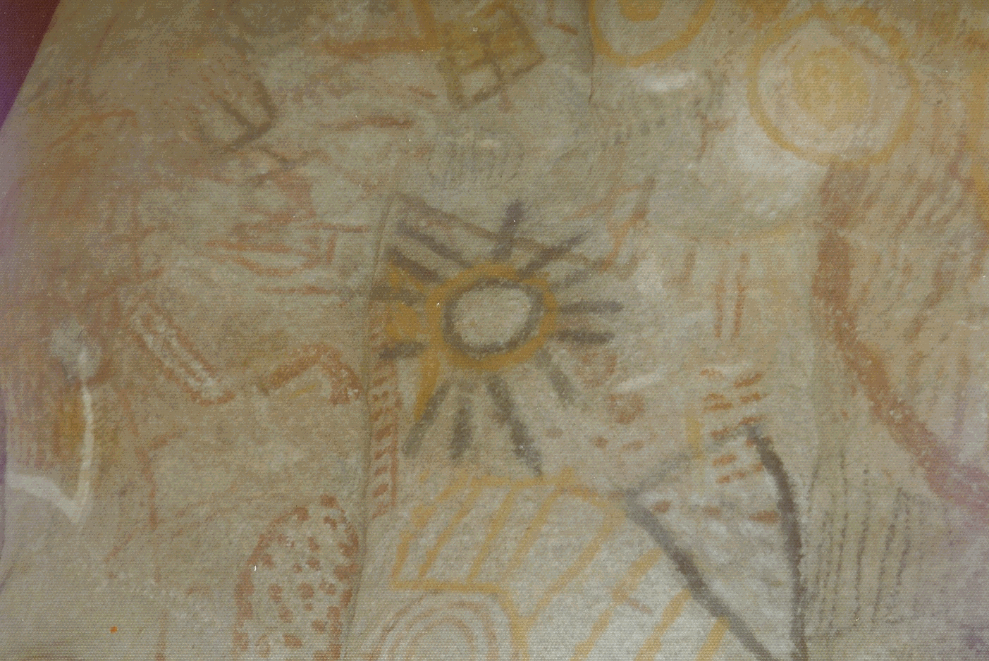
The first thing on Tom’s list for me was a cave painting at Catavina. He had not been there himself, but Jose had relatives at Santa Ines nearby that told him about it. So, my directions were third-hand, and not too accurate. We parked just north of a small arroyo north of Arroyo Catavina. We started walking upstream, looking for something that looked like a cave. I think I climbed up to the ridge to check out something, and found fresh tracks left by Tom and his group. I called the rest, and we followed the tracks to a very small cave, consisting of a large rock leaning on a smaller one. We almost had to get on hands and knees to get inside. We could not stand up straight inside. I have pictures of the paintings, all of which were on the ceiling. That cave is facing the highway, not more than three or four hundred yards away. The two openings are so small that one could walk past it a hundred times and not know it was there. Sad to say, when we passed that way in 1986 someone had painted a sign on the rock, so it has probably been demolished by now.
I had to lay on my back to get these pictures
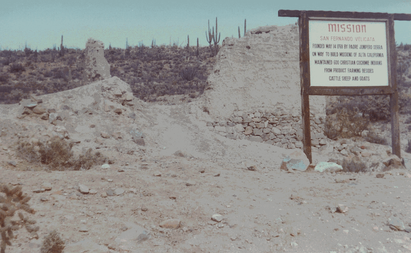
In the 1970’s my father organized a small group of people in Ensenada to make some effort to preserve the old Missions of Baja. They never raised much money, so the most they could do for preservation was to spray some of the old adobe walls to make them somewhat waterproof.
They also thought they should put up signs, so that those traveling the highways would know where to find the missions. If you have seen any of these old wooden signs, chances are that my father, with the help of Jose Cesena, put them there. Eventually those signs got the attention of the Mexican Government, and some much more enduring work was done to preserve that bit of History. My father did not live to see the fruits of his labor.
Leigh Robertson
Return to the Short Stories and Trips Page